|
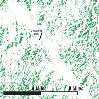
Solar SuitabilityThis map depicts solar suitability in areas of Maryland surrounding the Conowingo Dam and Susquehanna River. The map considers solar aspect, slope, and forestation. The areas in green are those with good solar aspect, moderate to shallow slope, and low forestation. The map is a composite image generated by overlaying information from the three maps below.
|
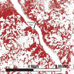
ForestationThe above map depicts areas of high forestation, as seen in red. Such areas are less suitable for solar panels than areas without forestation.
|
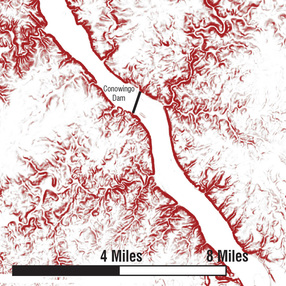
SlopeThe above map depicts areas of steep slope or cliffs, as seen in red. Such areas are considered less suitable for solar panels.
|
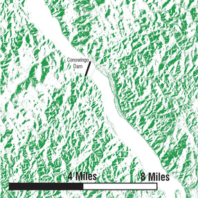
Solar AspectThe above map depicts areas of prime solar aspect. Areas in green receive high sun exposure throughout the year.
|
