The history of the Susquehanna River Basin is still unknown but there are choices that we can make to create a more prosperous future for all that call this basin home- whether fish in the river or people living on the banks. The Sharing Rivers class took a crack at understanding these different visions for the river’s future but in order to look ahead the class first looked back. Understanding the river's past helped the class create this shared vision for the river basin.
Mapping Change Over Time
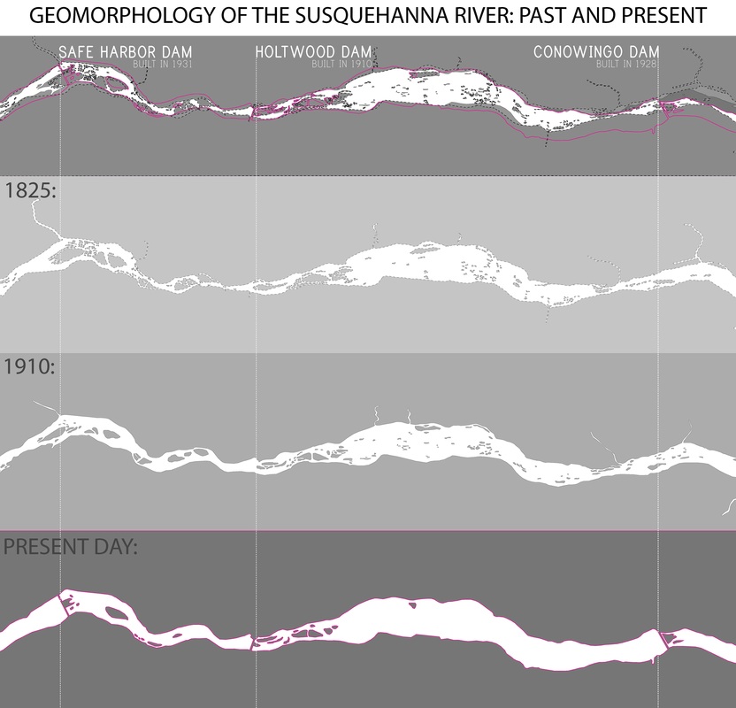
When compiling the below map a series of techniques were used to help all three maps, from different time periods, align correctly. The 1825 map was given to the team by Eric Gespersen, a Civil Engineer and GIS Analyst. The 1910 map was found on the ESRI Historic Map Explorer and the present day map was taken from Google Earth Imaging. When the maps were first overlaid key points such as towns and key geographic features were not aligning correctly. The 1825 map was then manipulated to have the key points match up, creating a better representation of how the river has changed over time.